Library
Browse and search books
397 novels found
《全汉文》编年系地与分布
Yi Xiaoping
This book is based on the research of the time and place of creation of "Quan Hanwen" and the author's birth and death dates and place of birth. It analyzes the distribution pattern, distribution center and changes of articles and authors' place of origin in various states in the Western Han Dynasty. Using the geographical structure of the author's life as a combination point, this book analyzes the distribution of the place of creation and the author's place of birth of "Quan Han Wen". The author's living conditions are used as the starting point to examine the relationship between the geographical flow of the author's life, the author's pursuit of fame, and the allocation of social resources, thereby constructing a literary historical geographical interpretation system that organically combines the restoration of time and space, the ontology of the work, and the author's subject.
This book is based on the research of the time and place of creation of "Quan Hanwen" and the author's birth and death dates and place of birth. It analyzes the distribution pattern, distribution center and changes of articles and authors' place of origin in various states in the Western Han Dynasty. Using the geographical structure of the author's life as a combination point, this book analyzes the distribution of the place of creation and the author's place of birth of "Quan Han Wen". The author's living conditions are used as the starting point to examine the relationship between the geographical flow of the author's life, the author's pursuit of fame, and the allocation of social resources, thereby constructing a literary historical geographical interpretation system that organically combines the restoration of time and space, the ontology of the work, and the author's subject.
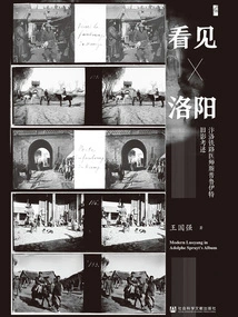
看见洛阳:汴洛铁路医师斯普鲁伊特旧影考述
Wang Guoqiang
Adolf Spruit, a Belgian railway physician who worked on the Bianluo Railway, worked in Luoyang for about three years from 1906 to 1908. In addition to his job, Adolf used the camera in his hand to take more than a hundred three-dimensional photos. Through Adolf's lens, we can not only understand the family life and leisure, photography, antiquities collection and other activities of Westerners in China at that time; we can also "see" many scenes of the clothing, food, housing, transportation, beliefs, and customs of Luoyang residents more than a hundred years ago. Adolf's Luoyang photo album has the characteristics of high definition and relative completeness. It contains text and image information unmatched by other photo albums of the same era. It is a precious material for studying modern Luoyang.
Adolf Spruit, a Belgian railway physician who worked on the Bianluo Railway, worked in Luoyang for about three years from 1906 to 1908. In addition to his job, Adolf used the camera in his hand to take more than a hundred three-dimensional photos. Through Adolf's lens, we can not only understand the family life and leisure, photography, antiquities collection and other activities of Westerners in China at that time; we can also "see" many scenes of the clothing, food, housing, transportation, beliefs, and customs of Luoyang residents more than a hundred years ago. Adolf's Luoyang photo album has the characteristics of high definition and relative completeness. It contains text and image information unmatched by other photo albums of the same era. It is a precious material for studying modern Luoyang.
Administrative Governance in Marginal Areas: a Re-study of the Office System in the Qing Dynasty
History边缘地带的行政治理:清代厅制再研究
Hu Heng
This book is a re-study of the "official system" issue in the Qing Dynasty. The hall system is a unique form of administrative division in the Qing Dynasty, and its establishment reflects the transformation of the local administrative system in the Ming and Qing Dynasties. This book has two focuses: first, it conducts detailed institutional historical research on the origin and evolution of the hall system in the Qing Dynasty, especially the origin process of the hall during the Ming and Qing Dynasties, which is relatively weak in academic research, and focuses on strengthening the exploration and utilization of first-hand archives on both sides of the Taiwan Strait; second, it combines regional social history, Using the research methods of legal history, the local manifestations of the bureau were analyzed in detail with typical cases, striving to organically combine the overall evolution of the system with regional social cases, showing how the bureau system coordinated with the historical process of regional society in the Qing Dynasty, and further reflected the characteristics of local governance in the Qing Dynasty of "governing according to customs".
This book is a re-study of the "official system" issue in the Qing Dynasty. The hall system is a unique form of administrative division in the Qing Dynasty, and its establishment reflects the transformation of the local administrative system in the Ming and Qing Dynasties. This book has two focuses: first, it conducts detailed institutional historical research on the origin and evolution of the hall system in the Qing Dynasty, especially the origin process of the hall during the Ming and Qing Dynasties, which is relatively weak in academic research, and focuses on strengthening the exploration and utilization of first-hand archives on both sides of the Taiwan Strait; second, it combines regional social history, Using the research methods of legal history, the local manifestations of the bureau were analyzed in detail with typical cases, striving to organically combine the overall evolution of the system with regional social cases, showing how the bureau system coordinated with the historical process of regional society in the Qing Dynasty, and further reflected the characteristics of local governance in the Qing Dynasty of "governing according to customs".
History and Place (Volume 5)
History史地(第5辑)
Editor-in-chief Zhang Sheng
"History and Geography" is a collection sponsored by the School of History of Nanjing University. It inherits the context of the famous academic journal "Journal of History and Geography" of Nanjing University's predecessor, Nanjing Normal School and National Southeast University. It was first published in 2017. "History and Geography" is positioned as a comprehensive study of history and geography across disciplines, times, and regions, focusing on "big articles" that combine theoretical thinking with empirical evidence. The columns include "Historical Preface", "Theoretical Controversy", "History and Human Geography", "Cross-border Nation-State Relations", "Marine History", "Cross-Cultural Research", "Archaeology", "Teaching and Talent Training", "Reading Notes and Academic Book Reviews", etc.
"History and Geography" is a collection sponsored by the School of History of Nanjing University. It inherits the context of the famous academic journal "Journal of History and Geography" of Nanjing University's predecessor, Nanjing Normal School and National Southeast University. It was first published in 2017. "History and Geography" is positioned as a comprehensive study of history and geography across disciplines, times, and regions, focusing on "big articles" that combine theoretical thinking with empirical evidence. The columns include "Historical Preface", "Theoretical Controversy", "History and Human Geography", "Cross-border Nation-State Relations", "Marine History", "Cross-Cultural Research", "Archaeology", "Teaching and Talent Training", "Reading Notes and Academic Book Reviews", etc.
地图史研究:理论与实践
Xu Yongqing Editor-in-chief Wang Jiayao
"Map History Research: Theory and Practice" contains the papers of more than 20 domestic map history and historical geography scholars. It conducts in-depth research and discussion of theoretical and practical issues in map history and historical geography at home and abroad. It focuses on the latest academic achievements in theoretical exploration and discipline construction in the field of map history research in my country in recent years.
"Map History Research: Theory and Practice" contains the papers of more than 20 domestic map history and historical geography scholars. It conducts in-depth research and discussion of theoretical and practical issues in map history and historical geography at home and abroad. It focuses on the latest academic achievements in theoretical exploration and discipline construction in the field of map history research in my country in recent years.
形塑地景与人文:9—20世纪浙江宁绍平原水利研究
Geng Jin
This book takes the evolution of water conservancy projects in the Ningshao region of eastern Zhejiang as the research object, uses historical geography and environmental history as research methods, and explores a relatively new trend in the current research fields of environmental history and historical geography, that is, the intrinsic relationship between landscape history, historical geography, and environmental history. The author focuses on the theme of how the geographical landscape and cultural characteristics of the Ningshao Plain were formed today. In terms of landscape formation, the landscape shaping process and internal driving factors of river network water towns, estuary deltas, river valley plains and coastal highlands were discussed respectively. In the exploration of the relationship between culture and water conservancy in the Ningshao Plain, we try to answer the cultural power (document construction) in the settlement of water conservancy disputes in the Ningshao Plain and the impact of water conservancy in the generation of local myths.
This book takes the evolution of water conservancy projects in the Ningshao region of eastern Zhejiang as the research object, uses historical geography and environmental history as research methods, and explores a relatively new trend in the current research fields of environmental history and historical geography, that is, the intrinsic relationship between landscape history, historical geography, and environmental history. The author focuses on the theme of how the geographical landscape and cultural characteristics of the Ningshao Plain were formed today. In terms of landscape formation, the landscape shaping process and internal driving factors of river network water towns, estuary deltas, river valley plains and coastal highlands were discussed respectively. In the exploration of the relationship between culture and water conservancy in the Ningshao Plain, we try to answer the cultural power (document construction) in the settlement of water conservancy disputes in the Ningshao Plain and the impact of water conservancy in the generation of local myths.
天地之间:古地图中的中国故事
Editor-in-chief Chen Hongyan
Pictures are one of the earliest ways for humans to record life, and maps are an important branch of pictures. China's map tradition has been formed as early as the pre-Qin period and has always been closely related to politics, history and social life. Libraries are of extremely important significance in the collection and preservation of ancient map materials. Since the establishment of the Capital Library, maps have been one of the special collections of the National Library. This book uses 52 important ancient maps as coordinates to connect the historical context of China from pre-Qin to modern times, and explores the historical background, drawing techniques, version differences, collections, and later influences of the maps.
Pictures are one of the earliest ways for humans to record life, and maps are an important branch of pictures. China's map tradition has been formed as early as the pre-Qin period and has always been closely related to politics, history and social life. Libraries are of extremely important significance in the collection and preservation of ancient map materials. Since the establishment of the Capital Library, maps have been one of the special collections of the National Library. This book uses 52 important ancient maps as coordinates to connect the historical context of China from pre-Qin to modern times, and explores the historical background, drawing techniques, version differences, collections, and later influences of the maps.
中国古地图研究入门
Cheng Yinong
The book is divided into five chapters. The first chapter provides an overview of the development of ancient Chinese maps according to special topics; the second chapter introduces the basic historical materials for ancient map research; the third chapter reviews the history of ancient Chinese map research; and the fourth chapter, based on the content of the previous chapters, discusses classic research and current cutting-edge and hot issues. In addition, some key words are defined in Chapter 5.
The book is divided into five chapters. The first chapter provides an overview of the development of ancient Chinese maps according to special topics; the second chapter introduces the basic historical materials for ancient map research; the third chapter reviews the history of ancient Chinese map research; and the fourth chapter, based on the content of the previous chapters, discusses classic research and current cutting-edge and hot issues. In addition, some key words are defined in Chapter 5.
故土情深(英文)
Chen Weiqiang Lin Ying Luo Xi
This book is based in Quanzhou City, Fujian Province, and tells the stories of people who have made great contributions to the local area. It records that the overseas Chinese who left Quanzhou made huge contributions to the development of their ancestral country, hometown, and countries along the Maritime Silk Road. The history of overseas Chinese in Quanzhou recorded in the book is not only a history of immigration and struggle of overseas immigrants who worked hard and started their own business, but also proves that the history of overseas Chinese in Quanzhou is closely related to the fate of the country in modern times. It also proves that the history of overseas Chinese in Quanzhou is also a history of revolution and contribution of overseas Chinese who love their hometown, give back to their hometown, and build the motherland. It comprehensively demonstrates the great contributions made by overseas Chinese in Quanzhou to the construction of their hometown and the development of the motherland. The whole book focuses on the style and merits of the overseas Chinese in Quanzhou at every historical stage and in all walks of life since modern times, and fully embodies the spirit of the overseas Chinese in Quanzhou who love their hometown, love their motherland, embrace all rivers, love to fight and dare to win. Under this background, it is of epoch-making significance to compile the deeds of the overseas Chinese in Quanzhou, promote the spirit of the overseas Chinese in Quanzhou, and let the world know about Quanzhou.
This book is based in Quanzhou City, Fujian Province, and tells the stories of people who have made great contributions to the local area. It records that the overseas Chinese who left Quanzhou made huge contributions to the development of their ancestral country, hometown, and countries along the Maritime Silk Road. The history of overseas Chinese in Quanzhou recorded in the book is not only a history of immigration and struggle of overseas immigrants who worked hard and started their own business, but also proves that the history of overseas Chinese in Quanzhou is closely related to the fate of the country in modern times. It also proves that the history of overseas Chinese in Quanzhou is also a history of revolution and contribution of overseas Chinese who love their hometown, give back to their hometown, and build the motherland. It comprehensively demonstrates the great contributions made by overseas Chinese in Quanzhou to the construction of their hometown and the development of the motherland. The whole book focuses on the style and merits of the overseas Chinese in Quanzhou at every historical stage and in all walks of life since modern times, and fully embodies the spirit of the overseas Chinese in Quanzhou who love their hometown, love their motherland, embrace all rivers, love to fight and dare to win. Under this background, it is of epoch-making significance to compile the deeds of the overseas Chinese in Quanzhou, promote the spirit of the overseas Chinese in Quanzhou, and let the world know about Quanzhou.
湖湘人才史略
Yi Yongqing Tao Yongshu
Hunan has a history of numerous talents and elites. In this magical land, countless outstanding talents such as Zhou Dunyi, Wang Fuzhi, Tao Shu, Wei Yuan, He Changling, Zeng Guofan, Zuo Zongtang, Hu Linyi, Guo Songdu, Tan Sitong, Neng Xiling, etc. Were born, as well as Qu Yuan, Jia Yi, Liu Zongyuan, Zhu Jia Famous talents were either relegated, traveled, studied, or worked, and came to the land of Hunan to ask questions about the sky, mourn the hardships of the people, sigh with sorrow before rejoicing, and express their aspirations to save the country and the people. Today, when talent studies have become prominent, Hunan can be called a typical sample for the study of talent history. This book is the first comprehensive study of the development status and patterns of talents in Hunan from ancient times to the present.
Hunan has a history of numerous talents and elites. In this magical land, countless outstanding talents such as Zhou Dunyi, Wang Fuzhi, Tao Shu, Wei Yuan, He Changling, Zeng Guofan, Zuo Zongtang, Hu Linyi, Guo Songdu, Tan Sitong, Neng Xiling, etc. Were born, as well as Qu Yuan, Jia Yi, Liu Zongyuan, Zhu Jia Famous talents were either relegated, traveled, studied, or worked, and came to the land of Hunan to ask questions about the sky, mourn the hardships of the people, sigh with sorrow before rejoicing, and express their aspirations to save the country and the people. Today, when talent studies have become prominent, Hunan can be called a typical sample for the study of talent history. This book is the first comprehensive study of the development status and patterns of talents in Hunan from ancient times to the present.
Historical Research on the Western Regions and the Silk Road between the Tang and Yuan Dynasties
History唐元之间的西域与丝绸之路历史研究
Pay Horse
Since the mid-eighth century, the Tang Dynasty's rule in the Hexi Corridor and the Western Regions has gradually collapsed. From then until the beginning of the 13th century, the Central Plains Dynasty failed to bring this area under direct rule for four centuries, leaving very limited records in Chinese documents handed down from generation to generation. The Silk Road between the Tang and Yuan Dynasties therefore left a dark and unclear impression, often giving people a sense of its decline. This book mainly uses multi-lingual materials unearthed in the northwest region, especially Uighur documents, to restore the historical appearance of the Western Regions and the Silk Road during this period from different levels, including the origins of the ruling families of the main ethnic groups, changes in transportation roads, the development of emerging cities, the rise of merchant groups, and the distribution of the Nestorian network. The revelation of these specific historical facts strongly proves that the Silk Road trade and the economy of the areas along it achieved further development between the Tang and Yuan Dynasties.
Since the mid-eighth century, the Tang Dynasty's rule in the Hexi Corridor and the Western Regions has gradually collapsed. From then until the beginning of the 13th century, the Central Plains Dynasty failed to bring this area under direct rule for four centuries, leaving very limited records in Chinese documents handed down from generation to generation. The Silk Road between the Tang and Yuan Dynasties therefore left a dark and unclear impression, often giving people a sense of its decline. This book mainly uses multi-lingual materials unearthed in the northwest region, especially Uighur documents, to restore the historical appearance of the Western Regions and the Silk Road during this period from different levels, including the origins of the ruling families of the main ethnic groups, changes in transportation roads, the development of emerging cities, the rise of merchant groups, and the distribution of the Nestorian network. The revelation of these specific historical facts strongly proves that the Silk Road trade and the economy of the areas along it achieved further development between the Tang and Yuan Dynasties.
葱岭之外:亚欧文明的十字路口
Hou Yangfang
At the crossroads of Asian and European civilizations, Congling has witnessed thousands of years of historical changes. It has seen the Indo-European chariots rumbling past, Alexander's phalanx marching in order, Xuanzang's figure moving forward in the snow, Genghis Khan's cavalry roaring, and the roar of Russian artillery. The technological revolution of every era has left its mark here, and every collision of civilizations has sparked sparks here. But some things never change. The sun still rises in the east and sets in the west every day; snow water still flows down from the mountains, nourishing the oases; business travelers still rush on the road, exchanging goods and ideas; people from different civilizations still meet here and write new stories.
At the crossroads of Asian and European civilizations, Congling has witnessed thousands of years of historical changes. It has seen the Indo-European chariots rumbling past, Alexander's phalanx marching in order, Xuanzang's figure moving forward in the snow, Genghis Khan's cavalry roaring, and the roar of Russian artillery. The technological revolution of every era has left its mark here, and every collision of civilizations has sparked sparks here. But some things never change. The sun still rises in the east and sets in the west every day; snow water still flows down from the mountains, nourishing the oases; business travelers still rush on the road, exchanging goods and ideas; people from different civilizations still meet here and write new stories.
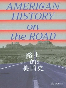
American History on the Road
History路上的美国史
Hayama
This book introduces roads that played an important role in American history, including famous trails, highways, railroads, waterways, and some abstract roads (such as the Trail of Tears for Native Americans to migrate westward and the Underground Railroad for slaves to escape). From the Great Indian Battle Trail, which the early Native tribes relied on, to the Boston Mail Road and the Great Wagon Road, which played a decisive role during the Revolutionary War, from the Oregon Trail, which led Americans to pursue Manifest Destiny during the Westward Expansion, to the Erie Canal, which set the United States on the stage of becoming a world power during the Industrial Revolution, from the Santa Fe Railroad, which gave birth to the "fast food chain," to the Lincoln Highway, which allowed the entire United States to "get on the automobile." These roads are not only important transportation arteries in history, but also shape the economic, cultural and social structure of the United States today to varying degrees. History not only has time clues, it also has equally wonderful spatial clues. By understanding the rise and decline of these roads, we can understand the history and social changes of the United States from a spatial perspective, and understand the relationship between major historical events and ordinary trivial events.
This book introduces roads that played an important role in American history, including famous trails, highways, railroads, waterways, and some abstract roads (such as the Trail of Tears for Native Americans to migrate westward and the Underground Railroad for slaves to escape). From the Great Indian Battle Trail, which the early Native tribes relied on, to the Boston Mail Road and the Great Wagon Road, which played a decisive role during the Revolutionary War, from the Oregon Trail, which led Americans to pursue Manifest Destiny during the Westward Expansion, to the Erie Canal, which set the United States on the stage of becoming a world power during the Industrial Revolution, from the Santa Fe Railroad, which gave birth to the "fast food chain," to the Lincoln Highway, which allowed the entire United States to "get on the automobile." These roads are not only important transportation arteries in history, but also shape the economic, cultural and social structure of the United States today to varying degrees. History not only has time clues, it also has equally wonderful spatial clues. By understanding the rise and decline of these roads, we can understand the history and social changes of the United States from a spatial perspective, and understand the relationship between major historical events and ordinary trivial events.
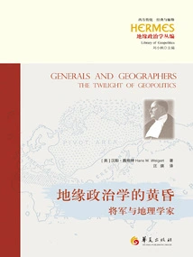
地缘政治学的黄昏:将军与地理学家
(us) Hans Weigert
This book is an intellectual biography of the German geopolitical scientist Haushofer. The author Hans Weigert shows the origins of German geopolitical thought, and focuses on analyzing the ideological connection between Haushofer and Spengler, Ratzel, and Mackinder, clarifying the important value of Haushofer's thought in understanding Pacific geopolitics. Weigert criticized Haushofer for being responsible for the foreign expansion of the German nation, believing that his doctrine advocated German conquest based on natural laws and ignored human nature. However, Haushoferism is not the root cause of German geopolitics; it is just a symptom of modern Western diseases. This book was written in 1942, shortly after the outbreak of the Pacific War. Although it is eighty years ago, it still has reference value for the formation of our understanding of geopolitics.
This book is an intellectual biography of the German geopolitical scientist Haushofer. The author Hans Weigert shows the origins of German geopolitical thought, and focuses on analyzing the ideological connection between Haushofer and Spengler, Ratzel, and Mackinder, clarifying the important value of Haushofer's thought in understanding Pacific geopolitics. Weigert criticized Haushofer for being responsible for the foreign expansion of the German nation, believing that his doctrine advocated German conquest based on natural laws and ignored human nature. However, Haushoferism is not the root cause of German geopolitics; it is just a symptom of modern Western diseases. This book was written in 1942, shortly after the outbreak of the Pacific War. Although it is eighty years ago, it still has reference value for the formation of our understanding of geopolitics.
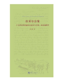
拉采尔公案:十九世纪的普遍历史意识与生物-政治地理学
Liu Xiaofeng
The role of political geography, developed from the biogeography of the German geographer Ratzel, in the turbulence of the world's political landscape in the twentieth century is still debated. Starting from this "Ratzel Public Case", this book reviews the major changes in the last century of world history, combs through a huge amount of historical materials, describes Europe's political growth experience and its geographical expansion, and pays attention to the impact of Anglo-American political growth on the political growth of modern European civilization, especially on the political growth of Germany. This book attempts to lead readers through the surface of modern Western civilization and penetrate into its inner texture from the perspective of political history, in order to stimulate our reflection on geopolitical consciousness.
The role of political geography, developed from the biogeography of the German geographer Ratzel, in the turbulence of the world's political landscape in the twentieth century is still debated. Starting from this "Ratzel Public Case", this book reviews the major changes in the last century of world history, combs through a huge amount of historical materials, describes Europe's political growth experience and its geographical expansion, and pays attention to the impact of Anglo-American political growth on the political growth of modern European civilization, especially on the political growth of Germany. This book attempts to lead readers through the surface of modern Western civilization and penetrate into its inner texture from the perspective of political history, in order to stimulate our reflection on geopolitical consciousness.
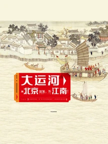
大运河:从北京出发,下江南!
Zeng Zirong
There were no cameras in ancient times, but fortunately, ancient painters recorded what they saw and heard in paintings... Please accept this "ticket" for the Grand Canal, enter 25 famous paintings handed down from generation to generation, and enjoy a tour of the Grand Canal. Under the delicate brushwork of the ancients, it is like watching a geographical and historical documentary on paper. Traveling between boats, along the route of the Grand Canal, passing through 9 famous historical and cultural cities: Beijing, Tianjin, Dezhou, Tai'an, Huai'an Qingkou, Yangzhou, Guazhou, Suzhou, and Hangzhou. Along the way, you can see geography, learn history, feel the customs, explore the wisdom of the ancients, and listen to the past and present of the Grand Canal, as well as the endless legends that live on the canal.
There were no cameras in ancient times, but fortunately, ancient painters recorded what they saw and heard in paintings... Please accept this "ticket" for the Grand Canal, enter 25 famous paintings handed down from generation to generation, and enjoy a tour of the Grand Canal. Under the delicate brushwork of the ancients, it is like watching a geographical and historical documentary on paper. Traveling between boats, along the route of the Grand Canal, passing through 9 famous historical and cultural cities: Beijing, Tianjin, Dezhou, Tai'an, Huai'an Qingkou, Yangzhou, Guazhou, Suzhou, and Hangzhou. Along the way, you can see geography, learn history, feel the customs, explore the wisdom of the ancients, and listen to the past and present of the Grand Canal, as well as the endless legends that live on the canal.
葛剑雄文集8:何以中国
Ge Jianxiong
Where did China's long history begin? How did Chinese civilization take root and thrive and endure for a long time? How did the Chinese nation thrive and develop into a big family of fifty-six ethnic groups today? Professor Ge Jianxiong's dozens of new works in recent years, with his profound historical accumulation and unique practical insights, tell the origin and development of Chinese civilization from the oracle bones and bronzes that carry the dawn of civilization, to the Yellow River and Yangtze River that gave birth to countless splendid cultures, to the canals and the Silk Road that influence regional and world exchanges. This is not only a review of history, but also an in-depth discussion of cultural self-confidence, guiding us to rethink the foundation and future of Chinese culture in the complex and ever-changing present.
Where did China's long history begin? How did Chinese civilization take root and thrive and endure for a long time? How did the Chinese nation thrive and develop into a big family of fifty-six ethnic groups today? Professor Ge Jianxiong's dozens of new works in recent years, with his profound historical accumulation and unique practical insights, tell the origin and development of Chinese civilization from the oracle bones and bronzes that carry the dawn of civilization, to the Yellow River and Yangtze River that gave birth to countless splendid cultures, to the canals and the Silk Road that influence regional and world exchanges. This is not only a review of history, but also an in-depth discussion of cultural self-confidence, guiding us to rethink the foundation and future of Chinese culture in the complex and ever-changing present.
Mysterious Western Region
History神秘的西域
Huang Wenbi
This book is based on Mr. Huang Wenbi's "History and Geography of the Northwest". It selects and compiles the most important expositions from topics such as Xinjiang's mountains and water systems, and the distribution and changes of the countries in the Western Regions, to reflect the author's main research characteristics of closely integrating history, geography, and archaeology. This book is of far-reaching significance for contemporary Chinese readers to have an in-depth understanding of this land in the northwest.
This book is based on Mr. Huang Wenbi's "History and Geography of the Northwest". It selects and compiles the most important expositions from topics such as Xinjiang's mountains and water systems, and the distribution and changes of the countries in the Western Regions, to reflect the author's main research characteristics of closely integrating history, geography, and archaeology. This book is of far-reaching significance for contemporary Chinese readers to have an in-depth understanding of this land in the northwest.
Ganjiang River Flows North
History赣江向北流
Li Guiping
Ganjiang River is the mother river of Jiangxi, flowing endlessly, and the cultural creations are equally graceful and graceful. "Ganjiang River Flows North" focuses on showing readers the long history, culture and humanistic sentiments along the Ganjiang River. The author also elaborates on it from the perspective of social and economic development. Each constitutes a relatively independent system and mainly tells the impact and significance of Ganjiang culture on the development of the cultural history of the Chinese nation. The author has his own unique understanding, understanding and thinking about the history and culture of this land, and is also rich in historical imagination. The work closely combines historical inquiry with cultural search, rational thinking and literary imagination, interweaves the dual inquiry of history and reality, and is full of characteristics and enlightenment significance as historical and cultural prose.
Ganjiang River is the mother river of Jiangxi, flowing endlessly, and the cultural creations are equally graceful and graceful. "Ganjiang River Flows North" focuses on showing readers the long history, culture and humanistic sentiments along the Ganjiang River. The author also elaborates on it from the perspective of social and economic development. Each constitutes a relatively independent system and mainly tells the impact and significance of Ganjiang culture on the development of the cultural history of the Chinese nation. The author has his own unique understanding, understanding and thinking about the history and culture of this land, and is also rich in historical imagination. The work closely combines historical inquiry with cultural search, rational thinking and literary imagination, interweaves the dual inquiry of history and reality, and is full of characteristics and enlightenment significance as historical and cultural prose.
科特迪瓦:第2版(列国志·新版)
Compiled By Liu Tiannan
Côte d'Ivoire is located in the west of the African continent, bordering the Atlantic Ocean port of Guinea to the south. It has the largest port in West Africa and is also an important seaport for the landlocked countries Mali and Burkina Faso. The superior geographical location, open and inclusive foreign policy and the rapid and dynamic economic development in recent years have made Côte d'Ivoire once again the hub of West Africa. The tourism industry ranks first in the region and is known as the "Little Paris of West Africa". This book provides a relatively detailed introduction to Côte d'Ivoire's land, economy, politics, history, culture, society, diplomacy, etc.
Côte d'Ivoire is located in the west of the African continent, bordering the Atlantic Ocean port of Guinea to the south. It has the largest port in West Africa and is also an important seaport for the landlocked countries Mali and Burkina Faso. The superior geographical location, open and inclusive foreign policy and the rapid and dynamic economic development in recent years have made Côte d'Ivoire once again the hub of West Africa. The tourism industry ranks first in the region and is known as the "Little Paris of West Africa". This book provides a relatively detailed introduction to Côte d'Ivoire's land, economy, politics, history, culture, society, diplomacy, etc.
澳大利亚研究(第3辑)
Editor-in-chief Sun Youzhong
"Australian Studies" is sponsored by the China Australia Studies Association and the Australian Studies Center of Beijing Foreign Studies University. It is the first interdisciplinary academic collection of Australian country studies in China. It mainly collects academic articles in various fields such as Australian politics, economy, diplomacy, culture, history, etc. Each issue sets a different research theme, focuses on contemporary times, takes into account history, and advocates interdisciplinary research. It aims to create an authoritative platform for Chinese Australian studies and comprehensively display the new results of Australian country studies.
"Australian Studies" is sponsored by the China Australia Studies Association and the Australian Studies Center of Beijing Foreign Studies University. It is the first interdisciplinary academic collection of Australian country studies in China. It mainly collects academic articles in various fields such as Australian politics, economy, diplomacy, culture, history, etc. Each issue sets a different research theme, focuses on contemporary times, takes into account history, and advocates interdisciplinary research. It aims to create an authoritative platform for Chinese Australian studies and comprehensively display the new results of Australian country studies.
History and Place (volume 4)
History史地(第4辑)
Editor-in-chief Zhang Sheng
"History and Geography" is a collection sponsored by the School of History of Nanjing University. It inherits the context of the famous academic journal "Journal of History and Geography" of Nanjing University's predecessor, Nanjing Normal School and National Southeast University. It was first published in 2017. "History and Geography" is positioned as a comprehensive study of history and geography across disciplines, times, and regions, focusing on "big articles" that combine theoretical thinking with empirical evidence. The columns include "Historical Preface", "Theoretical Controversy", "History and Human Geography", "Cross-border Nation-State Relations", "Marine History", "Cross-Cultural Research", "Archaeology", "Teaching and Talent Training", "Reading Notes and Academic Book Reviews", etc.
"History and Geography" is a collection sponsored by the School of History of Nanjing University. It inherits the context of the famous academic journal "Journal of History and Geography" of Nanjing University's predecessor, Nanjing Normal School and National Southeast University. It was first published in 2017. "History and Geography" is positioned as a comprehensive study of history and geography across disciplines, times, and regions, focusing on "big articles" that combine theoretical thinking with empirical evidence. The columns include "Historical Preface", "Theoretical Controversy", "History and Human Geography", "Cross-border Nation-State Relations", "Marine History", "Cross-Cultural Research", "Archaeology", "Teaching and Talent Training", "Reading Notes and Academic Book Reviews", etc.
南太平洋地区主义:历史变迁的逻辑
Chen Xiaochen
For international relations research, the South Pacific region is a huge unknown world. We still know too little about it and it is worth exploring in an academic way. Regionalism is a "door" to understanding this region. Regardless of academic value or practical value, the South Pacific region and its regionalism are like treasures on the seabed, waiting for more "treasure hunters" to dig deeper. This book attempts to sort out the history and context of the development of South Pacific regionalism, explore its evolutionary dynamics and logic, and draw a "treasure map" for the exploration of latecomers.
For international relations research, the South Pacific region is a huge unknown world. We still know too little about it and it is worth exploring in an academic way. Regionalism is a "door" to understanding this region. Regardless of academic value or practical value, the South Pacific region and its regionalism are like treasures on the seabed, waiting for more "treasure hunters" to dig deeper. This book attempts to sort out the history and context of the development of South Pacific regionalism, explore its evolutionary dynamics and logic, and draw a "treasure map" for the exploration of latecomers.
捷克:第2版(列国志·新版)
Compiled By Jiang Li
The Czech Republic, referred to as Czech Republic, is a young country that became independent on January 1, 1993. It is located in the middle of the European continent. The Czech Republic is a member of the European Union, NATO, the OECD, the Schengen Agreement and the Visegrad Group. The Czech Republic has beautiful and charming natural scenery, profound cultural and historical heritage, colorful folk customs, and a strong industrial foundation. It is the country in Central and Eastern Europe whose people's living standards are closest to the EU average. This book introduces Czech geography, history, politics, economy, culture, education, military and diplomacy with detailed information.
The Czech Republic, referred to as Czech Republic, is a young country that became independent on January 1, 1993. It is located in the middle of the European continent. The Czech Republic is a member of the European Union, NATO, the OECD, the Schengen Agreement and the Visegrad Group. The Czech Republic has beautiful and charming natural scenery, profound cultural and historical heritage, colorful folk customs, and a strong industrial foundation. It is the country in Central and Eastern Europe whose people's living standards are closest to the EU average. This book introduces Czech geography, history, politics, economy, culture, education, military and diplomacy with detailed information.
地名里的广东:文化景观的区域分析
Wang Bin
Place names are the proper names that people give to natural or human geographical entities at a specific spatial location. Place names are also products of society. Their naming and evolution are always restricted by the level of social development. They have obvious regional, national and contemporary characteristics and have an indicative effect on regional geographical environment and human activities. Promoting research on regional place names can provide insight into the regional development process, human activity trajectories and changes in the geographical environment, highlight the activities and processes of regional human understanding of the region, and provide guidance for place name naming in the new era. This book is a pioneering work in the study of place names in Guangdong. Based on the understanding of Guangdong's geographical environment and the diachronic characteristics of the place names in the region, this book shows both comprehensible and visible landscape representations of the landscape of Guangdong's place names from the levels of categories and regional differentiation.
Place names are the proper names that people give to natural or human geographical entities at a specific spatial location. Place names are also products of society. Their naming and evolution are always restricted by the level of social development. They have obvious regional, national and contemporary characteristics and have an indicative effect on regional geographical environment and human activities. Promoting research on regional place names can provide insight into the regional development process, human activity trajectories and changes in the geographical environment, highlight the activities and processes of regional human understanding of the region, and provide guidance for place name naming in the new era. This book is a pioneering work in the study of place names in Guangdong. Based on the understanding of Guangdong's geographical environment and the diachronic characteristics of the place names in the region, this book shows both comprehensible and visible landscape representations of the landscape of Guangdong's place names from the levels of categories and regional differentiation.
中国地学会研究(1909—1924)
Xie Jigang
This book first clarifies the Chinese, Western, and Eastern origins of the Chinese Geological Society's doctrine and system, as well as its deformation and metamorphosis under the reflection of ancient and modern times, and understands that it has a far more complex appearance than the Eastern and Western and later specialized societies. Secondly, it reproduces the activities of the Chinese Geoscience Society in the academic and political fields in chronological order, and explores its organization, Career, personnel and influence, based on the interaction between internal self-change and external factors, reveal its connection with academia, politics and society; finally, on the basis of analyzing the articles of association, analyze the words and deeds of the leaders of the China Geological Society and the debates inside and outside the society, understand the personnel and interest disputes behind it, and explore its original intention.
This book first clarifies the Chinese, Western, and Eastern origins of the Chinese Geological Society's doctrine and system, as well as its deformation and metamorphosis under the reflection of ancient and modern times, and understands that it has a far more complex appearance than the Eastern and Western and later specialized societies. Secondly, it reproduces the activities of the Chinese Geoscience Society in the academic and political fields in chronological order, and explores its organization, Career, personnel and influence, based on the interaction between internal self-change and external factors, reveal its connection with academia, politics and society; finally, on the basis of analyzing the articles of association, analyze the words and deeds of the leaders of the China Geological Society and the debates inside and outside the society, understand the personnel and interest disputes behind it, and explore its original intention.
东亚文明(第5辑)
Chief Editor, Department Of Cultural Relics And Museum Studies, Nanjing Normal University
"East Asian Civilization" is an academic journal sponsored by the Department of Cultural Relics and Museology, School of Social Development, Nanjing Normal University. It aims to strengthen academic exchanges between domestic scholars and colleagues in the same field around the world, and promote the continuous development of East Asian archeology and cultural museums. The research scope of "East Asian Civilizations" is centered on China and widely oriented to the East Asian world. The fields involved include research on archaeology, history, cultural relics, museology, cultural heritage, etc. This collection hopes to promote the integration and innovation of research in related fields in East Asia through composite research methods. This book is the fifth volume of the collection, including pre-Qin archeology, archaeological research on cultural relics in historical periods, regional history and culture, scientific and technological archeology, history of archaeology, field archaeological reports, etc.
"East Asian Civilization" is an academic journal sponsored by the Department of Cultural Relics and Museology, School of Social Development, Nanjing Normal University. It aims to strengthen academic exchanges between domestic scholars and colleagues in the same field around the world, and promote the continuous development of East Asian archeology and cultural museums. The research scope of "East Asian Civilizations" is centered on China and widely oriented to the East Asian world. The fields involved include research on archaeology, history, cultural relics, museology, cultural heritage, etc. This collection hopes to promote the integration and innovation of research in related fields in East Asia through composite research methods. This book is the fifth volume of the collection, including pre-Qin archeology, archaeological research on cultural relics in historical periods, regional history and culture, scientific and technological archeology, history of archaeology, field archaeological reports, etc.
东帝汶(列国志·新版)
Compiled By Zhang Ting, Dai Yonghong And Zhao Sirui
East Timor is a country located at the eastern end of Timor Island in Southeast Asia. It has been colonized by Portugal for a long time in history. In 1975, the Portuguese government allowed East Timor to implement national self-determination. On May 20, 2002, the Democratic Republic of East Timor was officially established, becoming the youngest country in Asia. Timor-Leste is rich in oil and natural gas resources, and its economy relies heavily on oil and gas revenue and foreign aid. Its non-oil and gas economy is mainly based on traditional service industries and agriculture. In recent years, the Timor-Leste government has made reducing poverty and increasing employment its policy priorities, gradually increasing its fiscal budget, expanding public expenditures, and encouraging foreign investment to stimulate non-oil and gas economic growth. This book provides a comprehensive introduction to the history, politics, economy, military, society, culture and diplomacy of East Timor, which will be of great benefit to readers.
East Timor is a country located at the eastern end of Timor Island in Southeast Asia. It has been colonized by Portugal for a long time in history. In 1975, the Portuguese government allowed East Timor to implement national self-determination. On May 20, 2002, the Democratic Republic of East Timor was officially established, becoming the youngest country in Asia. Timor-Leste is rich in oil and natural gas resources, and its economy relies heavily on oil and gas revenue and foreign aid. Its non-oil and gas economy is mainly based on traditional service industries and agriculture. In recent years, the Timor-Leste government has made reducing poverty and increasing employment its policy priorities, gradually increasing its fiscal budget, expanding public expenditures, and encouraging foreign investment to stimulate non-oil and gas economic growth. This book provides a comprehensive introduction to the history, politics, economy, military, society, culture and diplomacy of East Timor, which will be of great benefit to readers.
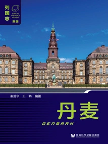
丹麦:第2版(列国志·新版)
Compiled By Wang He And Qin Aihua
Denmark is a developed country in Northern Europe known for its high welfare, with a world-leading per capita living standard and a harmonious and stable society. Denmark is Andersen's hometown and is world-famous for literature, art, and architectural design. Denmark has many magnificent royal palaces, marvelous and magnificent natural landscapes, and legendary fairy tale parks, making it a world-famous tourist destination. This book will give you a comprehensive understanding of this beautiful fairy tale kingdom from the aspects of history, politics, economy, military, society, culture and diplomacy.
Denmark is a developed country in Northern Europe known for its high welfare, with a world-leading per capita living standard and a harmonious and stable society. Denmark is Andersen's hometown and is world-famous for literature, art, and architectural design. Denmark has many magnificent royal palaces, marvelous and magnificent natural landscapes, and legendary fairy tale parks, making it a world-famous tourist destination. This book will give you a comprehensive understanding of this beautiful fairy tale kingdom from the aspects of history, politics, economy, military, society, culture and diplomacy.
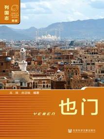
也门(列国志·新版)
Compiled By Sun Huimin And Su Ying
Yemen is located at the southwest end of the Arabian Peninsula, bordering Oman to the east, Saudi Arabia to the north, the Red Sea to the west, the Gulf of Aden and the Arabian Sea to the south, facing Eritrea and Djibouti across the Bab el-Mandeb Strait, and blocking the exit from the Red Sea to the Indian Ocean. Its strategic location is very important. Yemen has been an important transportation route between the East and the West since ancient times. It was once a transit station on the famous ancient Maritime Silk Road and the starting point of the Spice Road. Yemen is one of the countries co-building the "Belt and Road" and an important economic partner of China. China-Yemen cooperation has broad development prospects. This book comprehensively and systematically introduces the history, politics, economy, culture, society and diplomacy of Yemen.
Yemen is located at the southwest end of the Arabian Peninsula, bordering Oman to the east, Saudi Arabia to the north, the Red Sea to the west, the Gulf of Aden and the Arabian Sea to the south, facing Eritrea and Djibouti across the Bab el-Mandeb Strait, and blocking the exit from the Red Sea to the Indian Ocean. Its strategic location is very important. Yemen has been an important transportation route between the East and the West since ancient times. It was once a transit station on the famous ancient Maritime Silk Road and the starting point of the Spice Road. Yemen is one of the countries co-building the "Belt and Road" and an important economic partner of China. China-Yemen cooperation has broad development prospects. This book comprehensively and systematically introduces the history, politics, economy, culture, society and diplomacy of Yemen.
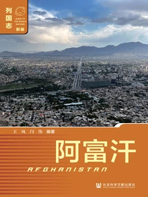
阿富汗:第2版(列国志·新版)
Compiled By Yan Wei And Wang Feng
Afghanistan is a landlocked country located in central and western Asia. It borders Turkmenistan, Uzbekistan, and Tajikistan to the north, Iran to the west, Pakistan to the south and east, and a narrow strip of land protruding from the northeast that borders China. It has a prominent geopolitical status. Afghanistan is rich in mineral resources, and its industry is dominated by light industry and handicrafts. Agriculture and animal husbandry are the main pillars of Afghanistan's national economy. China and Afghanistan have had close economic and cultural exchanges in history, and the relations between the two countries have broad prospects for development.
Afghanistan is a landlocked country located in central and western Asia. It borders Turkmenistan, Uzbekistan, and Tajikistan to the north, Iran to the west, Pakistan to the south and east, and a narrow strip of land protruding from the northeast that borders China. It has a prominent geopolitical status. Afghanistan is rich in mineral resources, and its industry is dominated by light industry and handicrafts. Agriculture and animal husbandry are the main pillars of Afghanistan's national economy. China and Afghanistan have had close economic and cultural exchanges in history, and the relations between the two countries have broad prospects for development.
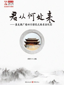
君从何处来:重走湖广填四川移民之路采访纪实
Editor-in-chief Zhou Yong
This book is a collection of the results of a large-scale all-media series of reports by "Chongqing Daily" "Where Did You Come From - Retracing the Road of Huguang and Sichuan Immigration". It tells the historical event of Huguang and Sichuan. With precious historical materials, legendary stories, and rich nostalgia, it touched the heartstrings of many audiences and aroused strong resonance.
This book is a collection of the results of a large-scale all-media series of reports by "Chongqing Daily" "Where Did You Come From - Retracing the Road of Huguang and Sichuan Immigration". It tells the historical event of Huguang and Sichuan. With precious historical materials, legendary stories, and rich nostalgia, it touched the heartstrings of many audiences and aroused strong resonance.
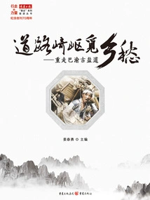
道路崎岖觅乡愁:重走巴渝古盐道
Editor-in-chief Jiang Chunyong
This book is one of the "The Power of Walking - Chongqing Daily's "Re-Walking" Series" and is a collection of the results of Chongqing Daily's 2016 large-scale field interview series of "Re-Walking the Ancient Salt Road and Feeling New Changes". The interview team was divided into four groups and spent more than a month revisiting the four ancient salt roads of Qi'an Salt Road, Bayan Ancient Salt Road, Fu'an Salt Road and Qinba Ancient Salt Road. The journey covered thousands of kilometers. The reporters climbed trails and waded through dangerous shoals, traveling through Chongqing, Hunan, Hubei and Guizhou. Between China and Shaanxi, we searched the streets and alleys and fields, excavated precious historical materials of the ancient salt road, explored the codes of Bayu culture, told the story of the rise and fall of the salt road, and reflected the great changes that have taken place in the districts and counties along the ancient salt road in the fight against poverty in recent years. Subsequently, "Chongqing Daily" published this series of reports in 20 pages, and simultaneously launched them on online media in the form of full-media reporting, which attracted widespread social attention.
This book is one of the "The Power of Walking - Chongqing Daily's "Re-Walking" Series" and is a collection of the results of Chongqing Daily's 2016 large-scale field interview series of "Re-Walking the Ancient Salt Road and Feeling New Changes". The interview team was divided into four groups and spent more than a month revisiting the four ancient salt roads of Qi'an Salt Road, Bayan Ancient Salt Road, Fu'an Salt Road and Qinba Ancient Salt Road. The journey covered thousands of kilometers. The reporters climbed trails and waded through dangerous shoals, traveling through Chongqing, Hunan, Hubei and Guizhou. Between China and Shaanxi, we searched the streets and alleys and fields, excavated precious historical materials of the ancient salt road, explored the codes of Bayu culture, told the story of the rise and fall of the salt road, and reflected the great changes that have taken place in the districts and counties along the ancient salt road in the fight against poverty in recent years. Subsequently, "Chongqing Daily" published this series of reports in 20 pages, and simultaneously launched them on online media in the form of full-media reporting, which attracted widespread social attention.
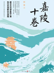
Jialing Ten Volumes
History嘉陵十卷
Aman
The author of this book has spent many years following the footsteps of the ancient scholar Li Daoyuan, and through on-site visits, he has verified the records in ancient classics such as "Shui Jing Zhu". In a way that compares history and reality, he gives a literary explanation of the social development of the Jialing River Basin from ancient times to modern times and the process of modernization, thereby helping readers understand this unique river of Jialing River.
The author of this book has spent many years following the footsteps of the ancient scholar Li Daoyuan, and through on-site visits, he has verified the records in ancient classics such as "Shui Jing Zhu". In a way that compares history and reality, he gives a literary explanation of the social development of the Jialing River Basin from ancient times to modern times and the process of modernization, thereby helping readers understand this unique river of Jialing River.
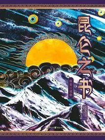
Book of Kunlun
History昆仑之书
Andis Chenfeng Ye Zhaozhuo Lu Yanghui
This book is a picture-text reading that provides a panoramic interpretation of the "Kunlun Myth". It uses the "Kunlun Myth" to reunite the essence, spirit, and spirit of Chinese mythology. The content of the book is drawn from ancient books of the past dynasties, such as "The Classic of Mountains and Seas", "Huainanzi", "Shenyi Jing" and "Taiping Yulan", combined with the research results of mythology in modern times, refined and processed into stories. Through eight chapters, it explains the original state, mythical state, image evolution of Kunlun Mountain and the source of its status as a cultural consensus. In addition to the text interpretation, it is supplemented by more than 150 purely hand-drawn illustrations, drawing inspiration from ancient Chinese paintings and traditional patterns, combined with modern aesthetic trends, giving the landscape, flowers and birds, gods and humans, and exotic animals an agile style, visually presenting the mysterious atmosphere of Kunlun.
This book is a picture-text reading that provides a panoramic interpretation of the "Kunlun Myth". It uses the "Kunlun Myth" to reunite the essence, spirit, and spirit of Chinese mythology. The content of the book is drawn from ancient books of the past dynasties, such as "The Classic of Mountains and Seas", "Huainanzi", "Shenyi Jing" and "Taiping Yulan", combined with the research results of mythology in modern times, refined and processed into stories. Through eight chapters, it explains the original state, mythical state, image evolution of Kunlun Mountain and the source of its status as a cultural consensus. In addition to the text interpretation, it is supplemented by more than 150 purely hand-drawn illustrations, drawing inspiration from ancient Chinese paintings and traditional patterns, combined with modern aesthetic trends, giving the landscape, flowers and birds, gods and humans, and exotic animals an agile style, visually presenting the mysterious atmosphere of Kunlun.
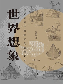
世界想象:西学东渐与明清汉文地理文献
Zou Zhenhuan
The spread of Western learning to the east from the 16th to the 19th centuries brought Chinese society into a unique period of cultural transformation. The Chinese and Western geographical documents formed during this period stirred up rich humanistic imagination about the world in Chinese society and intellectual circles. Through detailed research on Matteo Ricci's world map, Ai Julius's "Zi Fang Wai Ji" and other Ming and Qing Chinese Western geographical documents, this book shows the spread of Western geography and animal and plant knowledge in China since the Ming and Qing Dynasties, as well as the efforts made by Chinese intellectuals to bridge the gap between China and the West. This book pays special attention to putting these issues into the coordinates of China and the world in the context of global history, and attempts to sort out the complex aspects of the fierce collision and integration of Chinese and Western cultures around the geographical documents of the Ming and Qing Dynasties in the grand and magnificent historical picture of the spread of Western learning to the east.
The spread of Western learning to the east from the 16th to the 19th centuries brought Chinese society into a unique period of cultural transformation. The Chinese and Western geographical documents formed during this period stirred up rich humanistic imagination about the world in Chinese society and intellectual circles. Through detailed research on Matteo Ricci's world map, Ai Julius's "Zi Fang Wai Ji" and other Ming and Qing Chinese Western geographical documents, this book shows the spread of Western geography and animal and plant knowledge in China since the Ming and Qing Dynasties, as well as the efforts made by Chinese intellectuals to bridge the gap between China and the West. This book pays special attention to putting these issues into the coordinates of China and the world in the context of global history, and attempts to sort out the complex aspects of the fierce collision and integration of Chinese and Western cultures around the geographical documents of the Ming and Qing Dynasties in the grand and magnificent historical picture of the spread of Western learning to the east.
辽金农业地理
Han Maoli
This book is an academic work on the agriculture and geography of the Liao and Jin dynasties. It explores the relationship between man and land during the Liao and Jin dynasties from the perspective of broad agriculture. The Liao and Jin dynasties covered most of northern China, with unique natural geographical units and several important agricultural boundaries that traversed the entire region. Compared with the two Song dynasties, it experienced more drastic changes in politics, economy and even military affairs. The resulting social factors such as population migration continued to promote changes in the regional structure of agricultural production. When comprehensively restoring the agricultural geography of the Liao and Jin dynasties, the author focused on analyzing the environmental characteristics before the formation of grassland farming areas, the characteristics of population mobility after the establishment of the Liao and Jin dynasties, the regional characteristics of agricultural production activities, and the geographical pattern of crop types and planting systems. Based on traditional documents, combined with archaeological excavations and field investigations, the book provides an overall discussion of the regional characteristics and historical processes of agricultural activities in the Liao and Jin dynasties.
This book is an academic work on the agriculture and geography of the Liao and Jin dynasties. It explores the relationship between man and land during the Liao and Jin dynasties from the perspective of broad agriculture. The Liao and Jin dynasties covered most of northern China, with unique natural geographical units and several important agricultural boundaries that traversed the entire region. Compared with the two Song dynasties, it experienced more drastic changes in politics, economy and even military affairs. The resulting social factors such as population migration continued to promote changes in the regional structure of agricultural production. When comprehensively restoring the agricultural geography of the Liao and Jin dynasties, the author focused on analyzing the environmental characteristics before the formation of grassland farming areas, the characteristics of population mobility after the establishment of the Liao and Jin dynasties, the regional characteristics of agricultural production activities, and the geographical pattern of crop types and planting systems. Based on traditional documents, combined with archaeological excavations and field investigations, the book provides an overall discussion of the regional characteristics and historical processes of agricultural activities in the Liao and Jin dynasties.
宋代农业地理
Han Maoli
This book is an overall discussion of agricultural development and its geographical distribution in the two Song Dynasties for more than 300 years. The book not only macroscopically points out the importance of agricultural production to the national destiny and people's livelihood in the Song Dynasty, but also based on the regional differences caused by the natural environment and social factors in the Song Dynasty, from the aspects of population, land, crops, water conservancy, agricultural technology, etc., Discusses the agricultural production characteristics of five regions in the Song Dynasty: the middle and lower reaches of the Yellow River, the southeast region, the Jinghu region, the Chuanxia region, and the Lingnan region. It focuses on the relationship between the southward shift of ancient China's economic center of gravity and the two-crop annual rice-wheat rotation system. This book constructs a research paradigm of "agricultural geography", with solid data and rigorous argumentation. It shows the complexity and differences of agricultural complexes in various places in the Song Dynasty, and accurately summarizes the characteristics of Song Dynasty agriculture in the history of Chinese agricultural development as a "connection between past and future". This book helps readers observe the political changes and economic development in the Song Dynasty through the "agricultural perspective", and has high academic reference value.
This book is an overall discussion of agricultural development and its geographical distribution in the two Song Dynasties for more than 300 years. The book not only macroscopically points out the importance of agricultural production to the national destiny and people's livelihood in the Song Dynasty, but also based on the regional differences caused by the natural environment and social factors in the Song Dynasty, from the aspects of population, land, crops, water conservancy, agricultural technology, etc., Discusses the agricultural production characteristics of five regions in the Song Dynasty: the middle and lower reaches of the Yellow River, the southeast region, the Jinghu region, the Chuanxia region, and the Lingnan region. It focuses on the relationship between the southward shift of ancient China's economic center of gravity and the two-crop annual rice-wheat rotation system. This book constructs a research paradigm of "agricultural geography", with solid data and rigorous argumentation. It shows the complexity and differences of agricultural complexes in various places in the Song Dynasty, and accurately summarizes the characteristics of Song Dynasty agriculture in the history of Chinese agricultural development as a "connection between past and future". This book helps readers observe the political changes and economic development in the Song Dynasty through the "agricultural perspective", and has high academic reference value.
西域四百年2:割据与融合
Li Dong
This book talks about disputes, migration, and separation to trade, culture, and reunification. It reproduces the historical stages of the Wei, Jin, Southern and Northern Dynasties in which turbulence and integration in the Western Regions coexisted, diversity and change were entangled, and literature and art shined. It writes the story of the annual rings of China. We will start from the chaos in the world at the end of the Eastern Han Dynasty to the unification of China by Emperor Wen of the Sui Dynasty, and continue to tell the story of the 400 years of the Wei, Jin, Southern and Northern Dynasties in the Western Regions after the "War between Han and Hungary". (The timeline of this book continues from the author's first book, "Four Hundred Years of the Western Regions: The Battle between Han and Hungary").
This book talks about disputes, migration, and separation to trade, culture, and reunification. It reproduces the historical stages of the Wei, Jin, Southern and Northern Dynasties in which turbulence and integration in the Western Regions coexisted, diversity and change were entangled, and literature and art shined. It writes the story of the annual rings of China. We will start from the chaos in the world at the end of the Eastern Han Dynasty to the unification of China by Emperor Wen of the Sui Dynasty, and continue to tell the story of the 400 years of the Wei, Jin, Southern and Northern Dynasties in the Western Regions after the "War between Han and Hungary". (The timeline of this book continues from the author's first book, "Four Hundred Years of the Western Regions: The Battle between Han and Hungary").
盛京奇景八卦街
Written By Yang Yongxin, Chief Editor Of The Joint Creation Office Of Bagua Street, Heping District, Shenyang
"The Wonders of Shengjing Bagua Street" aims to use Bagua Street as the entry point to conduct an investigation and pursuit of the culture of Bagua Street. It also aims to conduct an in-depth exploration and detailed combing of the cultural spirit of Shenyang, a famous historical and cultural city. "The Wonders of Shengjing Bagua Street" uses a creative method that combines historical facts and folk legends to record the construction and century-old history of Bagua Street from different angles, with 16 selected stories. Judging from these anecdotes, they are rich in content, including local customs, celebrity stories, behavioral norms, and principles of life. They are full of knowledge, thought, and readability. Some stories are not only spread in Liaoshen area, but also widely spread at home and abroad. It not only allows readers to broaden their horizons and becomes a talking point for ordinary people after dinner, but also provides a subtle education for young people to learn knowledge and experience and cultivate them with good moral sentiments and values. It also provides rich research materials for the history of modern economic development and urban construction.
"The Wonders of Shengjing Bagua Street" aims to use Bagua Street as the entry point to conduct an investigation and pursuit of the culture of Bagua Street. It also aims to conduct an in-depth exploration and detailed combing of the cultural spirit of Shenyang, a famous historical and cultural city. "The Wonders of Shengjing Bagua Street" uses a creative method that combines historical facts and folk legends to record the construction and century-old history of Bagua Street from different angles, with 16 selected stories. Judging from these anecdotes, they are rich in content, including local customs, celebrity stories, behavioral norms, and principles of life. They are full of knowledge, thought, and readability. Some stories are not only spread in Liaoshen area, but also widely spread at home and abroad. It not only allows readers to broaden their horizons and becomes a talking point for ordinary people after dinner, but also provides a subtle education for young people to learn knowledge and experience and cultivate them with good moral sentiments and values. It also provides rich research materials for the history of modern economic development and urban construction.
“非科学”的中国传统舆图:中国传统舆图绘制研究
Cheng Yinong
"Unscientific Traditional Chinese Maps - Research on Traditional Chinese Map Drawing" written by Cheng Yinong is a general work on the study of traditional Chinese cartography. The contents of this book include: a re-evaluation of the "Six Cartographies" and "Planning and Drawing Methods", the drawing methods and data sources of national general maps, the drawing history of ancient Chinese city maps, and the drawing methods of other types of maps, etc.
"Unscientific Traditional Chinese Maps - Research on Traditional Chinese Map Drawing" written by Cheng Yinong is a general work on the study of traditional Chinese cartography. The contents of this book include: a re-evaluation of the "Six Cartographies" and "Planning and Drawing Methods", the drawing methods and data sources of national general maps, the drawing history of ancient Chinese city maps, and the drawing methods of other types of maps, etc.
吐谷浑政权交通地理研究
Zhu Yuemei Kangwei
Tuyuhun is one of the local ethnic minority regimes established from the source of the Yellow River in the northwest to the Tao River basin in my country from the Southern and Northern Dynasties to the early Sui and Tang Dynasties. Because it was exposed to different geopolitical relationships at different historical stages, its traffic pattern has always undergone different changes. This is not only the result of the constraints of its living environment, but also the result of the changing relationship with its surroundings during its development process. During the special historical period of the Sixteen Kingdoms and the Northern and Southern Dynasties, although Tuyuhun's internal traffic was cramped and concentrated, its external traffic was very long and extensive. This reflected the difficulty of the Tuyuhun regime in establishing a foothold in the Hetao area. In particular, the pre-Qin, Western Qin, Southern Liang, Northern Wei and other regimes strongly squeezed the Tuyuhun's activity range from north to south. Although it restricted the tribe's development in the Hetao River Basin, it also promoted its development on the "Tuyuhun Road". In short, the changes and characteristics of the Tuyuhun traffic pattern can be reflected that during most of the period of its founding, the Tuyuhun regime was in a state of rushing westward and southward on the Tuyuhun Road, constantly seeking a foothold.
Tuyuhun is one of the local ethnic minority regimes established from the source of the Yellow River in the northwest to the Tao River basin in my country from the Southern and Northern Dynasties to the early Sui and Tang Dynasties. Because it was exposed to different geopolitical relationships at different historical stages, its traffic pattern has always undergone different changes. This is not only the result of the constraints of its living environment, but also the result of the changing relationship with its surroundings during its development process. During the special historical period of the Sixteen Kingdoms and the Northern and Southern Dynasties, although Tuyuhun's internal traffic was cramped and concentrated, its external traffic was very long and extensive. This reflected the difficulty of the Tuyuhun regime in establishing a foothold in the Hetao area. In particular, the pre-Qin, Western Qin, Southern Liang, Northern Wei and other regimes strongly squeezed the Tuyuhun's activity range from north to south. Although it restricted the tribe's development in the Hetao River Basin, it also promoted its development on the "Tuyuhun Road". In short, the changes and characteristics of the Tuyuhun traffic pattern can be reflected that during most of the period of its founding, the Tuyuhun regime was in a state of rushing westward and southward on the Tuyuhun Road, constantly seeking a foothold.
大同城市历史地理研究
Zhao Shuqing
Datong is located in the northern part of the Shanxi Plateau and the center of the Datong Basin. It is known as the "Key to the North" because it guards the choke points of Shanxi, Hebei and Mongolia. Since ancient times, northern nomads and Central Plains farming people have competed for important territory. Datong City is one of the first batch of historical and cultural cities approved by the State Council. The long history of urban development before the Qing Dynasty has been evolving under the alternating rule of the Han nationality and ethnic minority regimes, with distinctive characteristics of ethnic integration. The history of urban development of Datong is a typical inland frontier city in northern my country. This book systematically analyzes the urban transformation process of Datong from a historical geographical perspective and believes that it presents an urban spatial development pattern centered on the "outer city" of Pingcheng in the Northern Wei Dynasty, a functional urban setting with a "military town" as the main line, an urban street layout based on the "lifang structure", and an urban residential structure based on diverse integration. "Ethnic relations" are the macro-political factors that influence the development of Datong City, "One Belt and One Land" are the meso-level geographical factors that determine the functional positioning of Datong City, and "important border defense towns" are the micro-military factors that shape the urban construction pattern of Datong. Systematically summarizing the evolution patterns of Datong's urban historical geography is of great significance for expanding the field of urban historical geography research and providing theoretical support for urban development.
Datong is located in the northern part of the Shanxi Plateau and the center of the Datong Basin. It is known as the "Key to the North" because it guards the choke points of Shanxi, Hebei and Mongolia. Since ancient times, northern nomads and Central Plains farming people have competed for important territory. Datong City is one of the first batch of historical and cultural cities approved by the State Council. The long history of urban development before the Qing Dynasty has been evolving under the alternating rule of the Han nationality and ethnic minority regimes, with distinctive characteristics of ethnic integration. The history of urban development of Datong is a typical inland frontier city in northern my country. This book systematically analyzes the urban transformation process of Datong from a historical geographical perspective and believes that it presents an urban spatial development pattern centered on the "outer city" of Pingcheng in the Northern Wei Dynasty, a functional urban setting with a "military town" as the main line, an urban street layout based on the "lifang structure", and an urban residential structure based on diverse integration. "Ethnic relations" are the macro-political factors that influence the development of Datong City, "One Belt and One Land" are the meso-level geographical factors that determine the functional positioning of Datong City, and "important border defense towns" are the micro-military factors that shape the urban construction pattern of Datong. Systematically summarizing the evolution patterns of Datong's urban historical geography is of great significance for expanding the field of urban historical geography research and providing theoretical support for urban development.
Eu National History
History欧盟列国志
Tian Ye Li Zhengfang
This book mainly studies the historical development of the 27 EU member states. The time span is from prehistory to the present day, covering the historical process, national formation, state construction, and international relations of the EU member states. The book is divided into chapters based on geographical location and country. It is divided into 5 chapters: Northern Europe, Western Europe, Central Europe, Southern Europe and Eastern Europe. It is divided into sections based on specific countries. It includes 27 member states of the European Union. It integrates relevant historical documents from China and abroad, and includes the latest research results in the field of world history. This book analyzes relevant historical events from the perspectives of historical materialism and dialectical materialism, summarizes the laws of historical development, and discusses the process of European civilization, thereby providing first-hand information for relevant EU research.
This book mainly studies the historical development of the 27 EU member states. The time span is from prehistory to the present day, covering the historical process, national formation, state construction, and international relations of the EU member states. The book is divided into chapters based on geographical location and country. It is divided into 5 chapters: Northern Europe, Western Europe, Central Europe, Southern Europe and Eastern Europe. It is divided into sections based on specific countries. It includes 27 member states of the European Union. It integrates relevant historical documents from China and abroad, and includes the latest research results in the field of world history. This book analyzes relevant historical events from the perspectives of historical materialism and dialectical materialism, summarizes the laws of historical development, and discusses the process of European civilization, thereby providing first-hand information for relevant EU research.
丝绸之路发展史
Ma Manli Li Ding
This book is a multi-disciplinary empirical material using history, geography, archaeology, etc., Starting from the source of the Silk Road in prehistoric times to the contemporary "Belt and Road" spatial pattern, and discusses the formation, development and trade exchanges of the main routes of the Silk Road. This book has a broad vision, covers ancient and modern times, and covers both China and the West. It is an academic work with detailed historical facts, vivid writing, and strong readability.
This book is a multi-disciplinary empirical material using history, geography, archaeology, etc., Starting from the source of the Silk Road in prehistoric times to the contemporary "Belt and Road" spatial pattern, and discusses the formation, development and trade exchanges of the main routes of the Silk Road. This book has a broad vision, covers ancient and modern times, and covers both China and the West. It is an academic work with detailed historical facts, vivid writing, and strong readability.
拉丁美洲和加勒比概论
Xie Wenze
This book proposes a "1+2+3+4+5+6" knowledge framework about Latin America and the Caribbean, which is to regard the region as a whole and divide the countries in the region into two groups (Latin American countries and Caribbean countries). From the spatial dimension, the region is divided into three sub-geographical regions (Central America, the Caribbean, and South America) according to geographical location. From the time dimension, the development process of Latin America and the Caribbean is divided into four historical stages (the period of the formation of ancient indigenous agricultural civilization and land ownership, the period of colonial rule and the formation of large estates, the period of Caudillo's administration and the prosperity of primary product exports, and the period of populism and development transformation). For major Latin American countries, this book focuses on five aspects: economy, natural environment, society, politics, and international relations, while highlighting the respective characteristics of different countries. Land ownership, large estates, Caudilloism, populism, structuralism, and neoliberalism are six important historical and realistic clues that influence the development of Latin America and the Caribbean.
This book proposes a "1+2+3+4+5+6" knowledge framework about Latin America and the Caribbean, which is to regard the region as a whole and divide the countries in the region into two groups (Latin American countries and Caribbean countries). From the spatial dimension, the region is divided into three sub-geographical regions (Central America, the Caribbean, and South America) according to geographical location. From the time dimension, the development process of Latin America and the Caribbean is divided into four historical stages (the period of the formation of ancient indigenous agricultural civilization and land ownership, the period of colonial rule and the formation of large estates, the period of Caudillo's administration and the prosperity of primary product exports, and the period of populism and development transformation). For major Latin American countries, this book focuses on five aspects: economy, natural environment, society, politics, and international relations, while highlighting the respective characteristics of different countries. Land ownership, large estates, Caudilloism, populism, structuralism, and neoliberalism are six important historical and realistic clues that influence the development of Latin America and the Caribbean.
周游列馆之东北抗战馆群落
Cui Jizhou Xie Chunhe Jiang Bin
This book records the descriptions of the Anti-Japanese War museums and exhibition halls related to the Anti-Japanese War in various places in the three northeastern provinces in the form of the author's travel notes. Through the author's personal experience and inspection of the physical museums, this book explains the author's cognition and perception of the exhibition halls. The author selects some exhibition halls with regional characteristics and strong historical and cultural backgrounds for research and organization, and compares the similarities and differences among them to inspire readers and serve as a reference for researchers. Most of the selected exhibition halls are based on the theme of the Northeast Anti-Japanese War, reflecting the relevant content and historical discussion of the Northeast Anti-Japanese War.
This book records the descriptions of the Anti-Japanese War museums and exhibition halls related to the Anti-Japanese War in various places in the three northeastern provinces in the form of the author's travel notes. Through the author's personal experience and inspection of the physical museums, this book explains the author's cognition and perception of the exhibition halls. The author selects some exhibition halls with regional characteristics and strong historical and cultural backgrounds for research and organization, and compares the similarities and differences among them to inspire readers and serve as a reference for researchers. Most of the selected exhibition halls are based on the theme of the Northeast Anti-Japanese War, reflecting the relevant content and historical discussion of the Northeast Anti-Japanese War.
介休历史乡土地理研究
An Jiesheng Li Ga Jiang Jianguo
The study of historical rural geography focuses on the changes in regional geography in historical periods, with counties as the core unit, and is one of the important branches of historical geography. The content of this book is mainly divided into four parts, namely Cold Food Festival Culture, Political Regions and Place Names, Settlement Geography, and Disasters. It systematically combs and analyzes the changes in the historical geography of the Jiexiu area from various aspects such as Cold Food Festival culture, political region evolution and place name characteristics, settlement construction and distribution pattern, and the occurrence of disasters in historical periods. Among them, different interpretations and interpretations are put forward on major issues such as the cultural evolution of the Cold Food Festival and urban disasters, and the significance of academic innovation is outstanding. This book is a relatively rare research monograph on historical rural geography in China and has high academic value.
The study of historical rural geography focuses on the changes in regional geography in historical periods, with counties as the core unit, and is one of the important branches of historical geography. The content of this book is mainly divided into four parts, namely Cold Food Festival Culture, Political Regions and Place Names, Settlement Geography, and Disasters. It systematically combs and analyzes the changes in the historical geography of the Jiexiu area from various aspects such as Cold Food Festival culture, political region evolution and place name characteristics, settlement construction and distribution pattern, and the occurrence of disasters in historical periods. Among them, different interpretations and interpretations are put forward on major issues such as the cultural evolution of the Cold Food Festival and urban disasters, and the significance of academic innovation is outstanding. This book is a relatively rare research monograph on historical rural geography in China and has high academic value.
古都北京人地关系变迁
Sun Donghu Wu Wentao Gao Fumei
This book relies on historical geography and regional history, absorbs academic achievements in related disciplines, explains the historical impact of Beijing becoming the capital or companion capital on the city itself, surrounding areas and even other provinces in my country in terms of population, resources, environment, society, etc., And explores the "man-land relationship" caused by urban development. It focuses on the historical process of changes in the "system", the general rules and the interrelationships of various constituent elements. It is committed to paying attention to practical issues through historical research, trying to broaden the research fields of regional historical geography and local history, and providing theoretical support and historical reference for promoting the coordinated development of contemporary Beijing and the integrated development of Beijing, Tianjin and Hebei.
This book relies on historical geography and regional history, absorbs academic achievements in related disciplines, explains the historical impact of Beijing becoming the capital or companion capital on the city itself, surrounding areas and even other provinces in my country in terms of population, resources, environment, society, etc., And explores the "man-land relationship" caused by urban development. It focuses on the historical process of changes in the "system", the general rules and the interrelationships of various constituent elements. It is committed to paying attention to practical issues through historical research, trying to broaden the research fields of regional historical geography and local history, and providing theoretical support and historical reference for promoting the coordinated development of contemporary Beijing and the integrated development of Beijing, Tianjin and Hebei.